Dalit Lan and Associate Prof. Ayelet Baram-Tsabari, The Faculty of Education in Science and Technology, and Dr. Sagi Dalyot, Faculty of Civil and Environmental Engineering, Technion.
The ambition that school graduates will be able to acquire, interpret and use relevant new information throughout their lives is one of the main goals of the education system and is considered part of 21st Century skills. The Covid-19 crisis exposed the public to a great deal of scientific, quantitative-statistical and geographical information that which is essential to informed decisions making on individual and society level. Digital and static maps are central to COVID-19 pandemic related information and guidelines, so that the general public must understand and process geographical information from spatial representations.
This study aims to examine the application of spatial geographical practices in daily life and the relationship between these skills and the formal geographical instruction in school. The research question: To what extent is geographic literacy relevant to understanding and making informed decisions in students’ and adults’ daily lives?
Questionnaires examining the ability to interpret and use authentic maps in the context of the Corona crisis – the geographic literacy of 450 Hebrew-speaking adult respondents (18-70) and 640 students (7th-12th grade).
At the Geographical Association Conference, 2021, findings and insights emerged from the students’ and adults’ surveys in the lecture – Examining geographical literacy skills among school students: A case study of the COVID-19 pandemic.
A poster presenting the research was presented on the research day of the Faculty of Science and Technology Education at the Technion. See here.
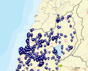
What is the meaning of the signs on the map?

The website of the Israeli Ministry of Health
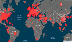
Why is all of Europe painted red?

The Center for Systems Science and Engineering (CSSE) at Johns Hopkins University


